We have detected that you are using Internet Explorer to visit this website. Internet Explorer is now being phased out by Microsoft. As a result, this website no longer supports any version of Internet Explorer. Some features on this site will not work. You should use a modern browser such as Edge, Chrome, Firefox, or Safari. If you have difficulty installing or accessing a different browser, please contact your IT support team.
Indicator 15.2.1
Progress towards sustainable forest management
Proxy
=
This indicator contains some alternative data to those specified by the United Nations (UN). This indicator is the most suitable match currently available.
Sub-categories
Choose categories from the dropdowns below to see different breakdowns of the data. Some will not be available until a higher level is chosen.
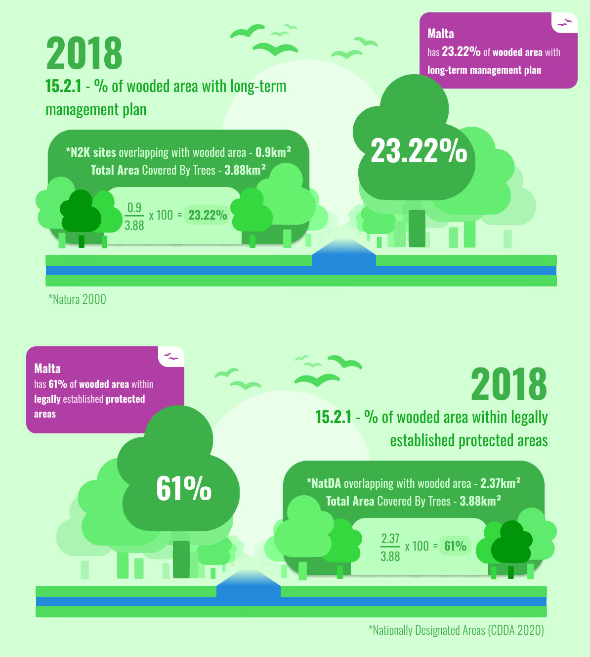
Nationally Designated Areas (CDDA 2020) overlapping with wooded area
2018
23.32
Percentage (%)
Percentage of wooded area with long-term management plan
2018
61.0
Percentage (%)
Percentage of wooded area within legally established protected areas
Source: Environment and Resources Authority (ERA)
Geographical Area:
Unit of Measurement:
Footnote:
For tabular data alternative see Table tab.
This table provides information on metadata for SDG indicators as defined by the UN Statistical Commission. Complete global metadata is provided by the UN Statistics Division.
Goal
Goal 15: Protect, restore and promote sustainable use of terrestrial ecosystems, sustainably manage forests, combat desertification, and halt and reverse land degradation and halt biodiversity loss
Indicator
Indicator 15.2.1: Progress towards sustainable forest management
Target
Target 15.2: By 2020, promote the implementation of sustainable management of all types of forests, halt deforestation, restore degraded forests and substantially increase afforestation and reforestation globally
Metadata update
2026-03-27
International organisations(s) responsible for global monitoring
Food and Agriculture Organization of the United Nations (FAO)
Related indicators
15.1.1: Forest area as a proportion of total land area
This table provides metadata for the proxy data used (closest to the UN SDG indicator) to report on the progress towards achieving the SDG Target. Please note that even when data for the actual UN SDG indicator is fully available, this table should still be consulted for any additional specific metadata information.
Method of computation
Malta has a limited extent of forest and woodland habitats compared to many other countries. For the purposes of this proxy indicator, wooded areas were derived from habitats reported under Article 17 of the Habitats Directive and related national spatial datasets. The indicator reflects woodland and forest-related habitats recognised within Malta’s national and EU environmental reporting frameworks. As definitions of forest and woodland vary across reporting systems, including those adopted by the Food and Agriculture Organization (FAO) and other international frameworks, the values presented here should not be interpreted as directly comparable to forest area estimates generated using alternative methodologies.
NOTE: The figures expressed in km² represent distinct indicators and may overlap geographically. They should therefore be interpreted separately and should not be summed to derive a total area. The percentages (%) refer solely to the proportion of the total wooded area that is either covered by a long-term management plan or falls within legally established protected areas. They should not be interpreted as percentages of the total terrestrial area of the Maltese Islands.
The calculations for the proxy indicators shown above were updated using the following sources, which contain more recent officially reported spatial data than those used in previous assessments:
Nationally Designated Areas (NatDA) formerly known as CDDA - NatDA dataset 2026
Reporting under Article 17 of the Habitats Directive (92/43/EEC) - Article 17 Report 2025